8 Ways Utility Mapping Improves Infrastructure Projects

By Emily Newton
Underground utility mapping is the unsung hero of water workers’ success when perfecting modern infrastructure. Water treatment and distribution demands are higher than ever, so plotting the ideal pipe and electrical network is essential for longevity, durability and climate resilience. How can a map have such a lasting impact on the workforce and affected citizens?
1. Asset Management and Inventory
A prominent drawback of conventional water infrastructure is the low visibility of assets over time. Underground utility mapping creates a vision for the system on paper, which is translatable to digital systems during execution. Connecting every valve and control to asset management software and sensors delivers unprecedented insights over massive infrastructure projects.
Manually overseeing these fixtures is often laborious and time-intensive. It is less so when mapping tracks everything from the life cycle of water mains to the conditions of hydrants. Underground utility mapping tells staff when to rehabilitate aging infrastructure or recalibrate new installations. Asset management potential increases when stakeholders can see maintenance histories on each facet of the map.
Mapping before a project also informs employees of inventory status. It considers how many resources will go into a retrofit or new build. It could also store information about acquired materials, such as decades-old cast iron pipes in need of recycling and replacing with a more sustainable alternative.
2. Conflict Detection and Mitigation
Water and sewage workers can combine underground utility mapping with other modern techniques to enhance diagnostics and prevent conflicts. Subsurface utility engineering (SUE) is a powerful resource for evaluating the geophysics of an area and assessing compatibility with the location. It also lowers risks associated with infrastructure relocation.
Using this tool alongside mapping could allow workers to discover high-pressure water lines nearby that new construction could damage or interrupt. Minimally invasive utility detection methods, like ground-penetrating radar or electromagnetic locators, are a ballooning market for this reason. There is an anticipated compound annual growth rate of around 5.48% by 2028, valuing $1.93 billion. Workers want to prevent service interruptions at all costs, and mapping mitigates oversights.
3. Regulatory Compliance and Permitting
Experts must report their projects and continued maintenance to regulatory agencies, such as the National Utility Locating Contractors Association (NULCA) and the Environmental Protection Agency (EPA). Using mapping techniques makes sites more compliant by making it easier to mark utilities for auditing. These techniques also contribute to NULCA’s goal of using training and frameworks to lower the damage of underground utility projects by 50% by 2028.
4. Enhanced Project Planning and Design
Mapping processes leverage innovative technologies. Utilities integrating these technologies into workflows will generate more accurate maps and collect data to inform future projects. Some of these techniques include but are not limited to:
- GPS and GIS data collection.
- Real-time data streaming.
- Photogrammetry.
- Lidar.
- Augmented reality mapping.
- Crowdsourced mapping.
- Indoor mapping.
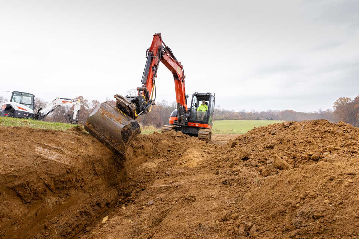
Knowing how existing systems function and using this data to make subsequent projects better for communities is critical. The insights could influence designs by suggesting varying flow rates. Technologically advanced mapping could also improve excavation equipment by employing precision modes to place pipes more efficiently into the dig site and controlling hydraulic influences. Maps help operators identify the best ways to program machinery or install utilities.
5. Risk Management and Safety
Mapping uses less destructive tools and techniques than traditional water infrastructure tactics. It makes job sites safer for personnel and neighborhoods in the long term by lowering incident rates. For example, radar and crowdsourced mapping could discover contaminated water and soil impacting existing pipes.
The information catalyzes more productive remediation, by first engaging with local soil experts to restore the area and using excavation machinery befitting the area’s structural integrity. This forward-thinking approach eliminates risks associated with pollutant exposure, cave-ins and falls.
Novel water infrastructure fixtures necessitate intricate maps, especially for growing sectors like underwater construction. These complex builds of piles and caissons must consider the dangers of underwater electrical needs, employee diving and material changes from extended water exposure.
6. Cost Efficiency
If an unrelated construction project disrupts a water main or utility line, workers and citizens suffer the consequences of poor planning. A strike on underground utilities could potentially cost organizations tens of thousands of dollars and months of downtime, exacerbating expenses further. In 2021, there were 192,745 reported events, wasting more than 1,927,000 million hours of work and utility efficiency.
Underground utility mapping shares knowledge with all experts working within an area. Transparency increases, with everyone aware of the risks of careless installations near vulnerable water equipment. Companies investing in mapping may save thousands in labor and rehabilitation costs because they can better communicate with other companies on navigating the region.
7. Stakeholder Collaboration
Mapping makes it more straightforward for stakeholders to collaborate with utility employees, as the enhanced data visualization and detail ensure all parties have the same information. Consider how a municipality might need a water infrastructure overhaul and request contractor bids. The municipality can share maps with any prospective partners to increase the quality and relevance of incoming proposals, strengthening clear communication from the start.
8. Life Cycle Management
Imagine how a constantly updating 3D reconstruction of water utility infrastructure could help workers know the life cycle of their work, as opposed to manual inspections.
Research of 323 underground utilities proves how mapping extends the life cycle of these fixtures in several ways. It eliminates losses and deficiencies in maintenance by including more detailed information about everything from pipeline materials to the dimensions of specific parts.
Maps also guide machinery if technicians need to remotely operate tech to investigate concerns. Subterranean interventions could cause more concerns because of human error and pressure changes. However, maps lengthen the life cycle of all assets by making equipment guidance more precise thanks to enhanced spatial awareness.
Underground Utility Mapping as a Planning Standard
Sewage and water workers must advocate for more productive, cost-efficient and safe infrastructure installation. Mapping is the foundation for achieving these goals. Without careful planning via these technologies, water infrastructure may not survive heightened demand or environmental stressors. Strong, durable infrastructure forges a healthier population by providing uninterrupted services and clean water to all.
Emily Newton is a construction and industrial journalist. She is also the Editor-in-Chief for Revolutionized Magazine. Keep up with Emily by subscribing to Revolutionized’s Newsletter.